Log in
All resources
Create a design
1,095,865 Free Images of Maps Of Chaldea
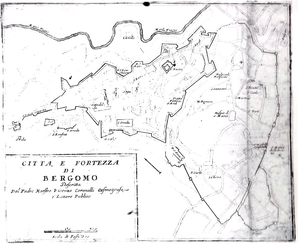
geographical illustrations by coronelli
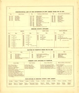
new jersey
maps in the library of congress
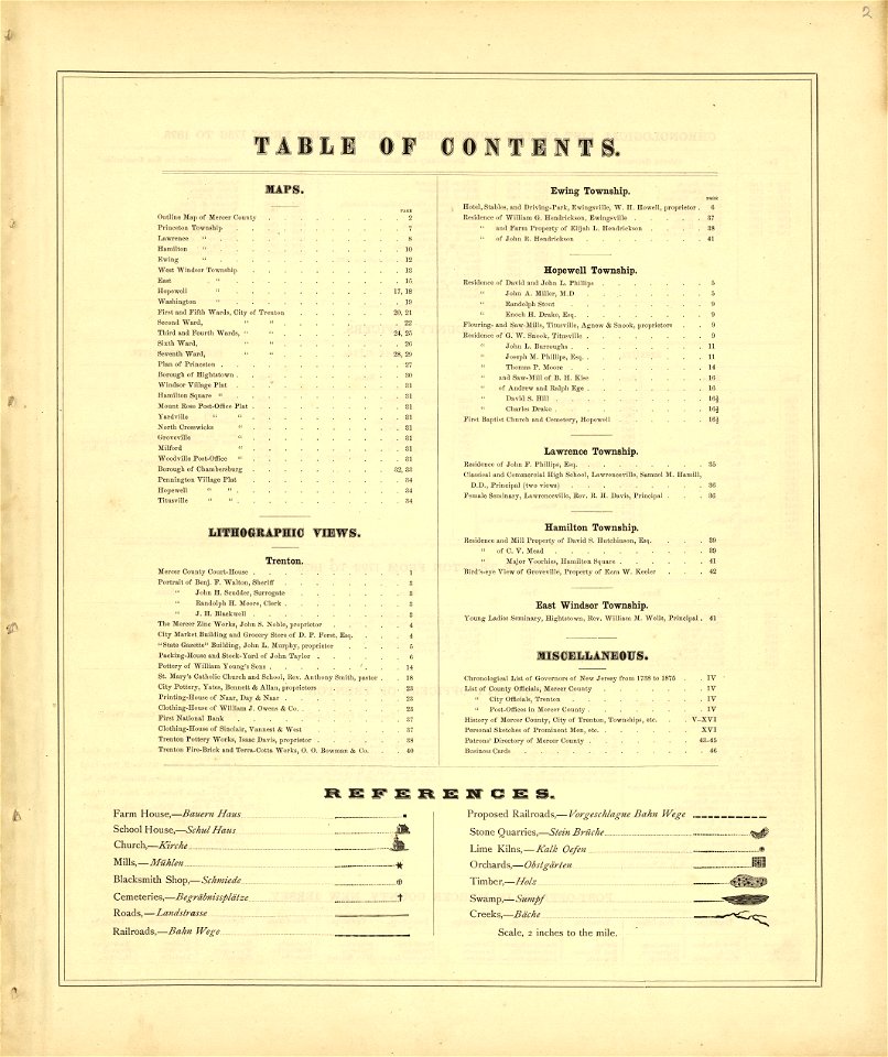
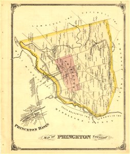
combination atlas map of mercer county
old maps of the peloponnese
enzyklopädie des eisenbahnwesens
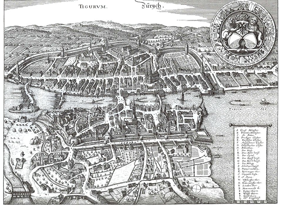
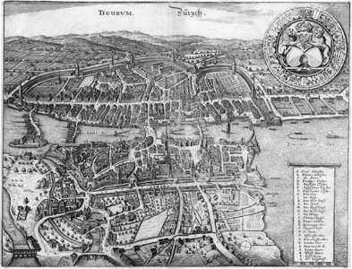
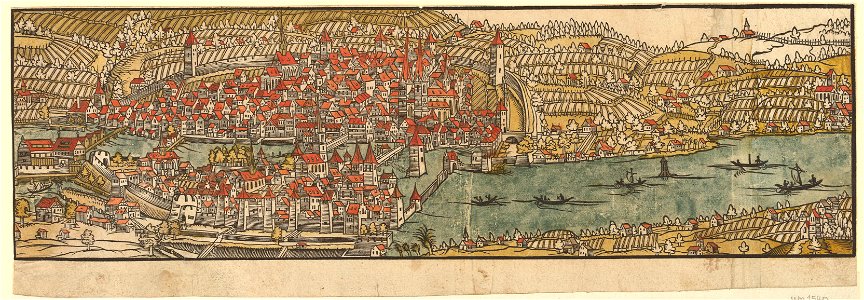
old maps of zürich
cosmographia - beschreibung aller lender durch sebastianum munsterum (1545)
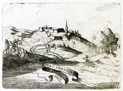
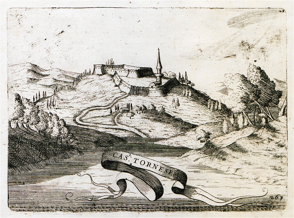
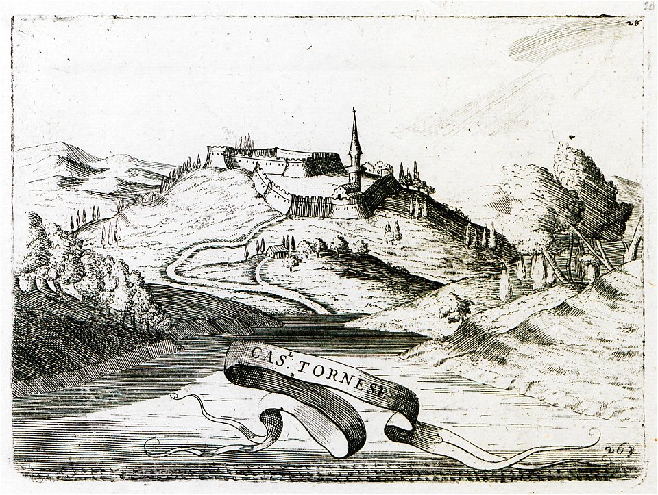
coronelli's cas. tornese
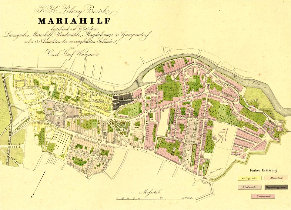
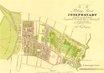
1830 vienna map series by carl graf vasquez
maps in the library of congress
new jersey
maps in the library of congress
new jersey
history of argos
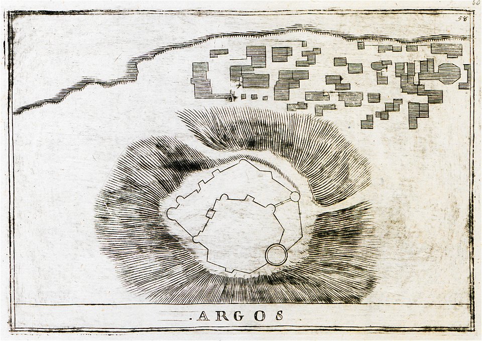
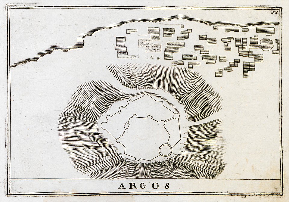
argos castle
history of argos
argos castle
maps in the library of congress
new jersey
maps in the library of congress
new jersey
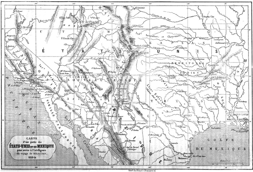
19th-century maps of the united states
volume 1 of le tour du monde
old maps of lazio
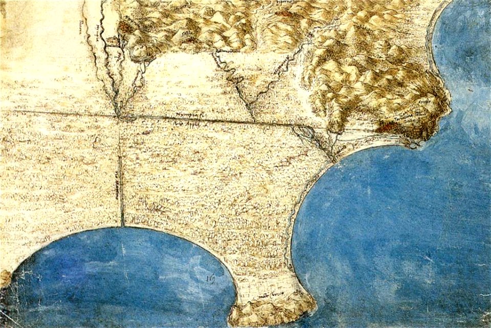
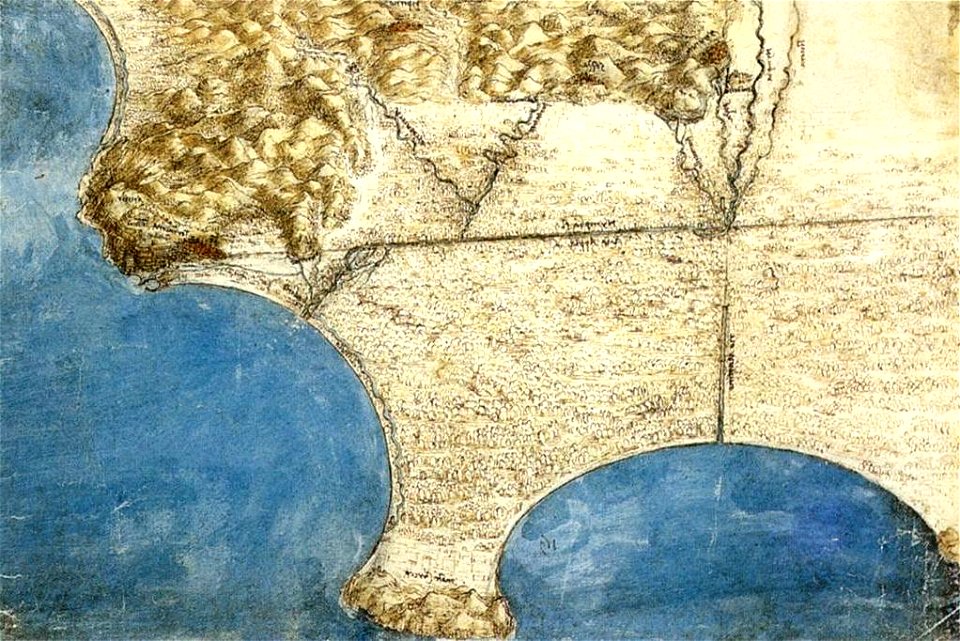
codex windsor
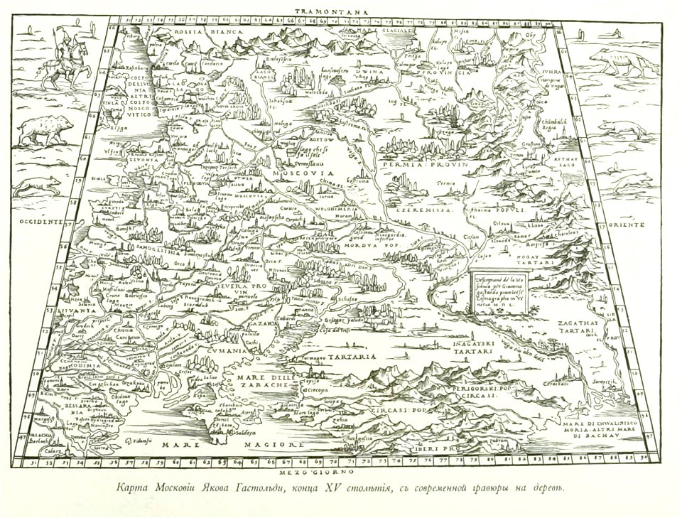
small atlas of the russian empire (1796)
kharkov viceroyalty
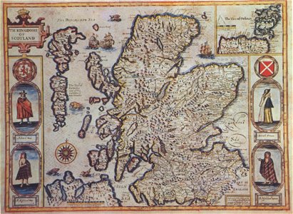
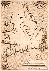
scotland in the 17th century
history of scotland
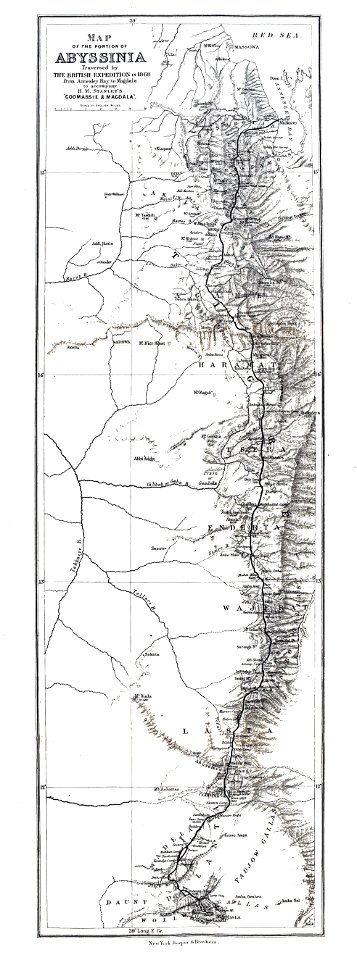
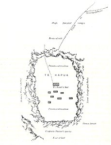
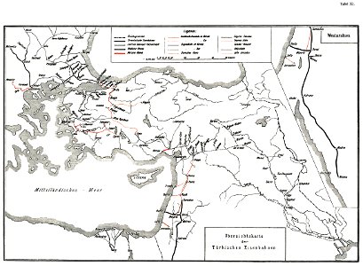
british expedition to abyssinia
henry morton stanley
map of paris by claes jansz. visscher - derivate files
historical maps of les halles
volume 9 of le tour du monde
john hanning speke
old maps of lazio
codex windsor
maps in the library of congress
new jersey
maps in the library of congress
new jersey
maps in the library of congress
new jersey
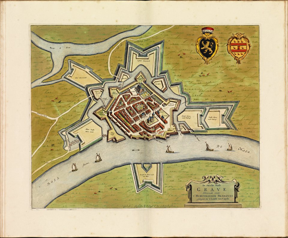
construction drawings in the stadsarchief amsterdam
nicolas visscher
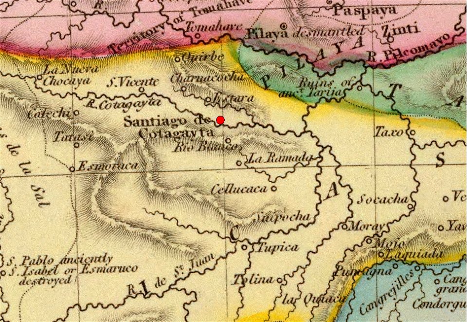
history of argentina from independence to the constitution of 1853
maps by john pinkerton
history of argentina from independence to the constitution of 1853
maps by john pinkerton
1638 in switzerland
sihlkanal (zürich)
kutepov's hunting - illustrations (volume 1)
old maps of the tsardom of russia
old maps of zürich
zürich
battle of trafalgar
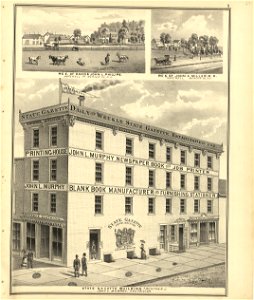
printing
military history of new zealand
maps of battles
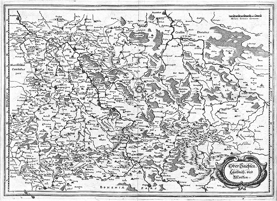
engravings of topographia saxoniae inferioris
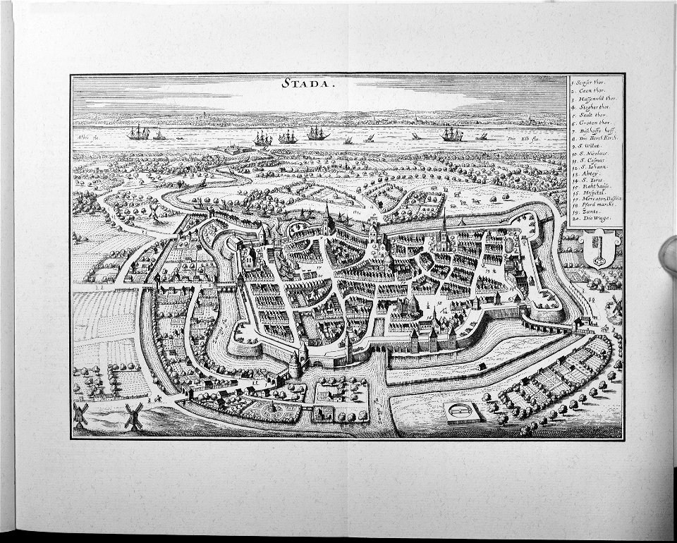
old maps of bremen (state)
engravings of topographia saxoniae inferioris
stadtbefestigung stade
history of rail transport in switzerland
rail transport maps of switzerland
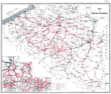
history of rail transport in belgium
enzyklopädie des eisenbahnwesens
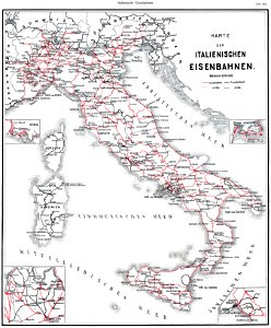
history of rail transport in italy
enzyklopädie des eisenbahnwesens
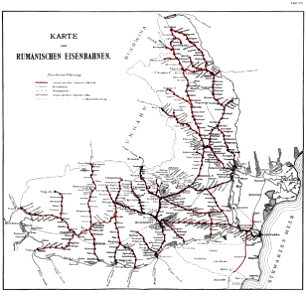
history of rail transport in romania
enzyklopädie des eisenbahnwesens
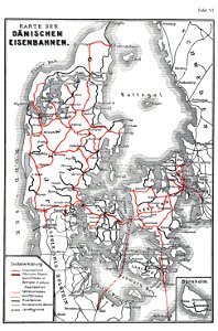
history of rail transport in denmark
enzyklopädie des eisenbahnwesens
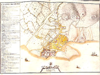
18th-century maps of liguria
matteo vinzoni
prints from the peace palace library
1652
engravings of topographia superioris saxoniae
thüringiae
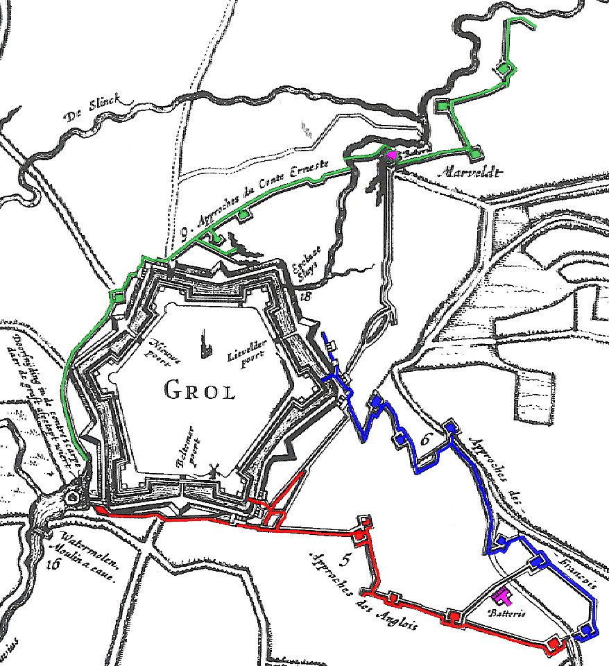
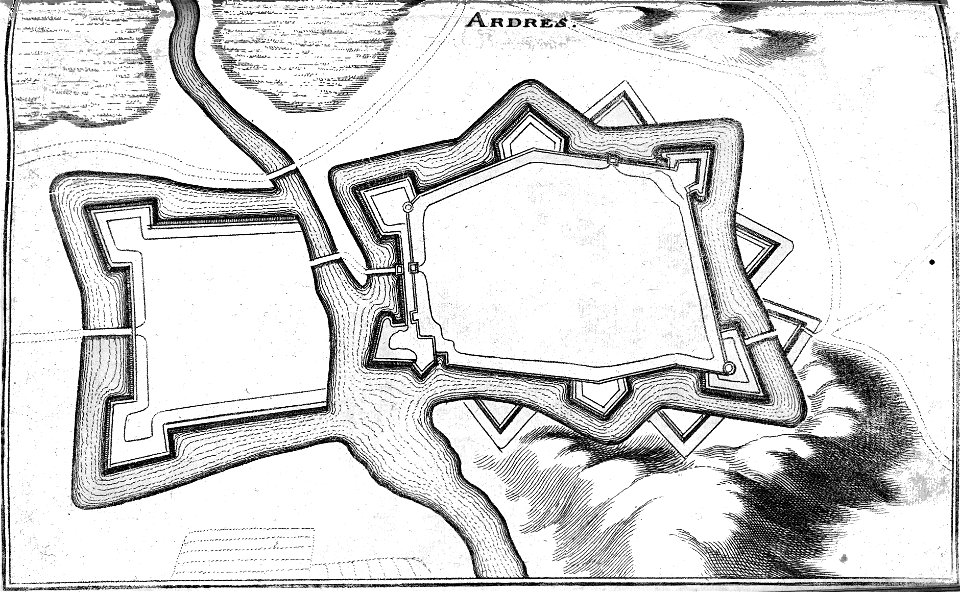
17th-century fortress plans
military trenches
great siege of malta paintings at the royal museums greenwich
old maps of valletta
bonds and shares of edhac members
mendrisio electric tramway
history of rail transport in turkey
enzyklopädie des eisenbahnwesens
historical maps of warsaw
warsaw in the 1840s
ämteratlas des fürstentums lüneburg von johannes mellinger
mein
voyagie door italien
dalmatien
collection de la bibliothèque municipale de reims
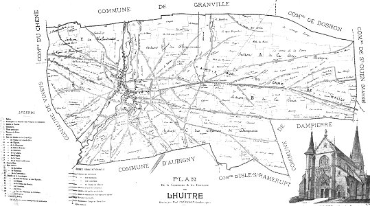
old maps of aube
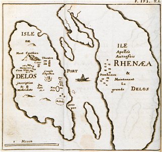
relation d'un voyage du levant 1718
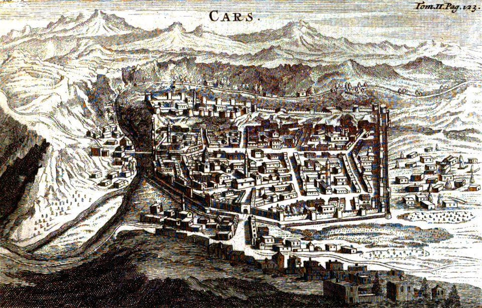
old pictures and maps of kars
old maps of zürich
merian helvetiae
university of toronto wenceslas hollar digital collection
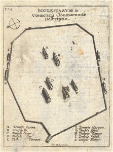
clonmacnoise
1830 vienna map series by carl graf vasquez
old maps of mariahilf
1830 vienna map series by carl graf vasquez
old maps of vienna
1830 vienna map series by carl graf vasquez
old maps of josefstadt
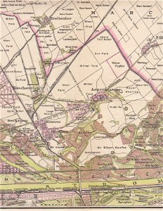
breitenlee
aspern
graphische sammlung der zentralbibliothek zürich
old maps of zürich
fortified farms
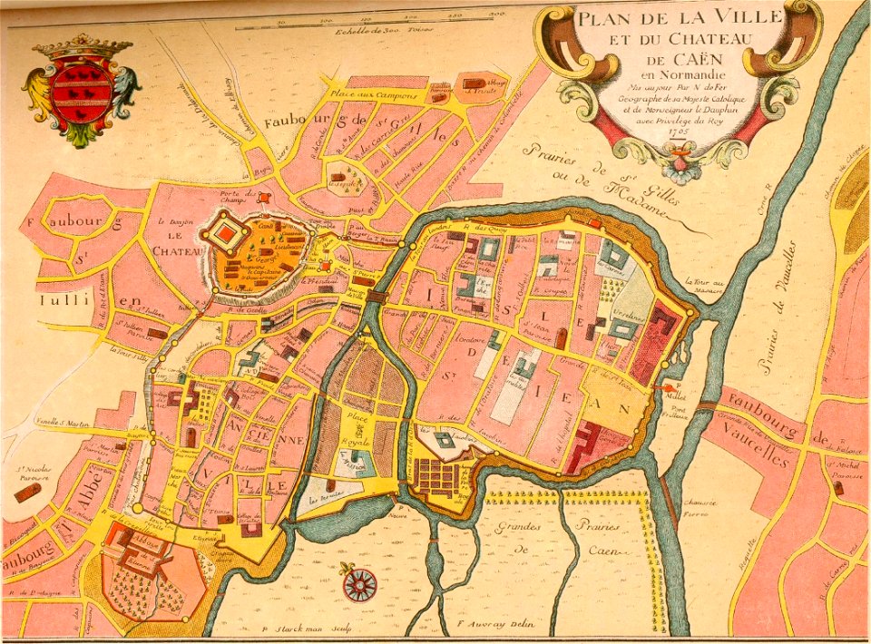
nicolas de fer
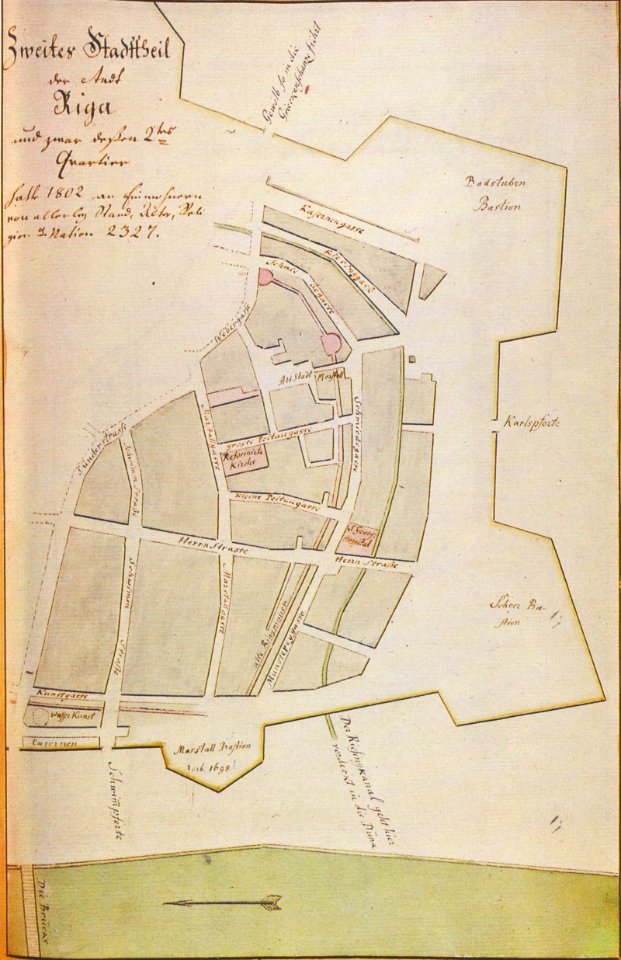
johann christoph brotze
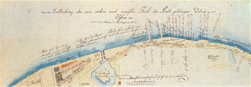
old maps of riga
mura venete (bergamo)
old maps of bergamo
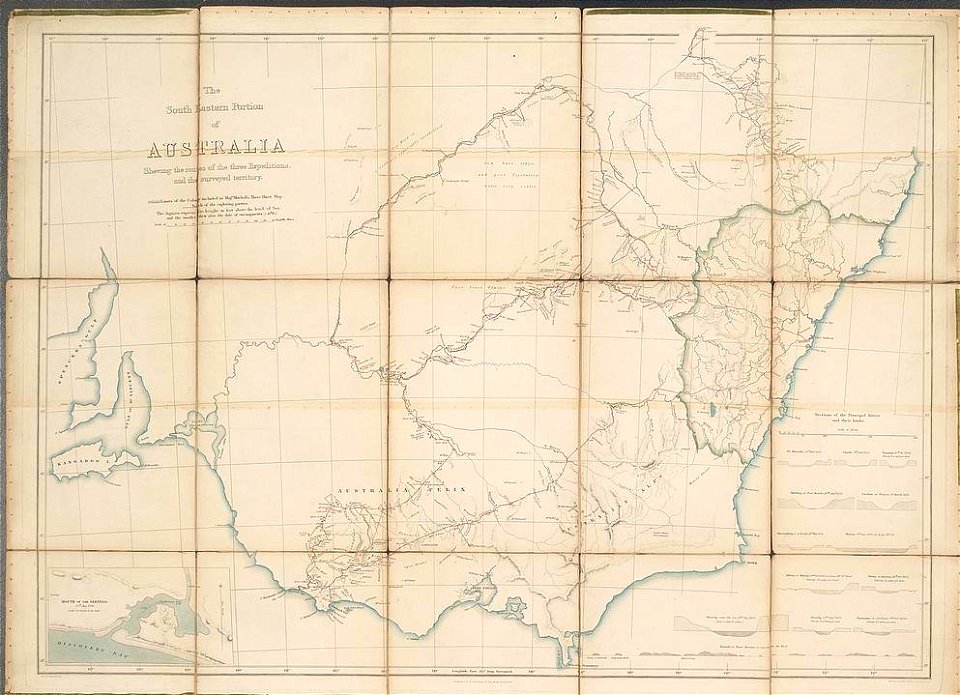
19th-century maps of new south wales
thomas livingstone mitchell
bibliothèque municipale de reims
rès. g 152
david rumsey historical map collection
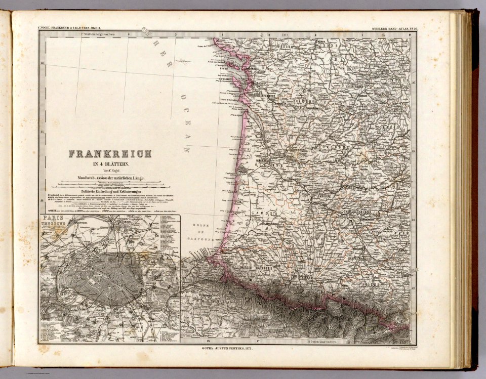
old maps of france
atlantis magni tomus tertius (biblioteca comunale di trento)
1690s maps of germany
geographical illustrations by coronelli
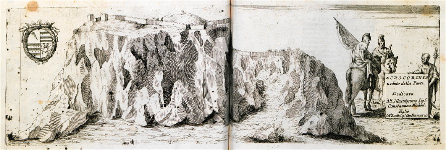
acrocorinth in art
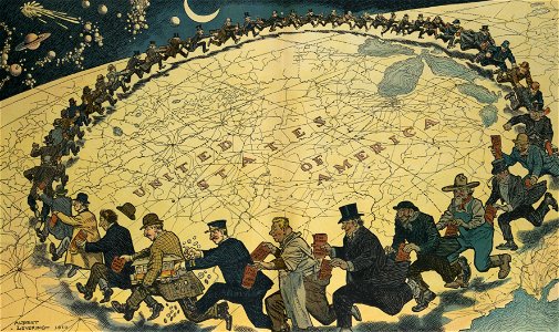
puck
1910
atlas de wit 1698
frederick de wit
old maps of groningen (province)
frederick de wit
maps by brockhaus
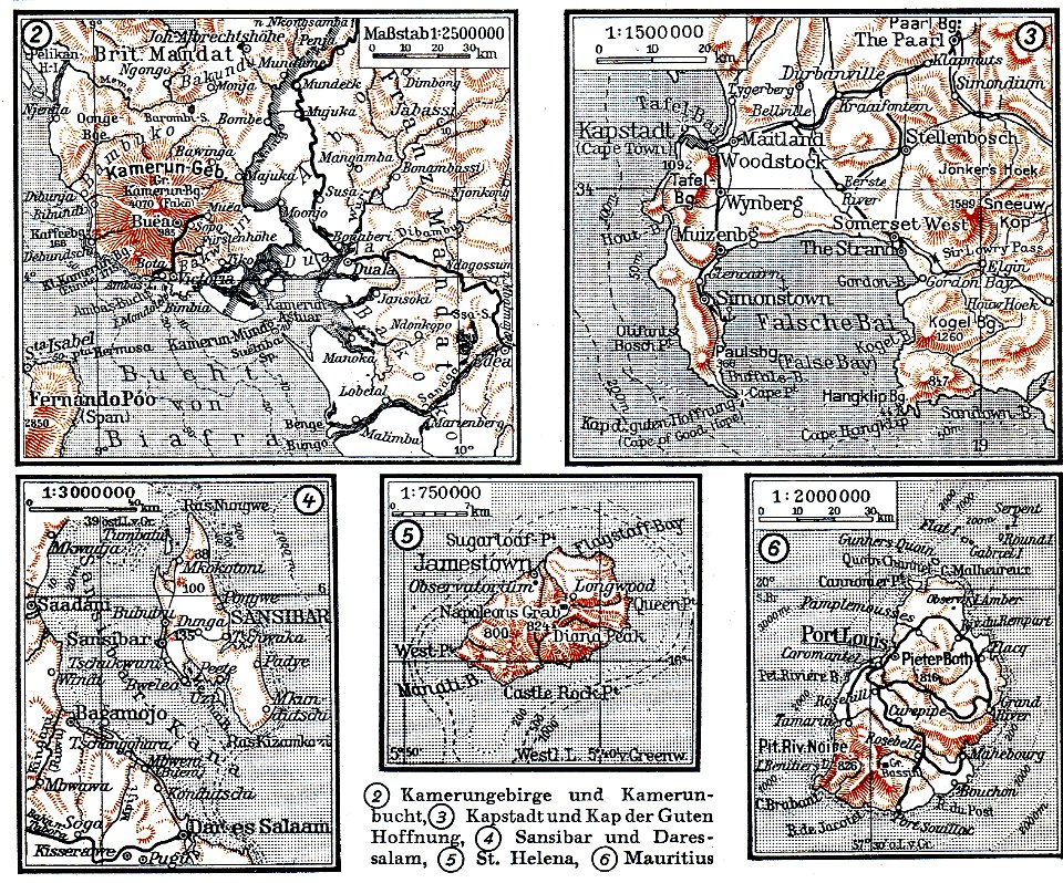
mount cameroon
bibliothèque municipale de reims
rès. g 152
atlas schoemaker
oldenzaal
atlas schoemaker-noord-holland
atlas schoemaker
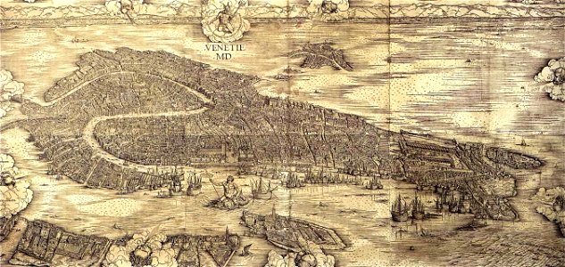
images of venice by jacopo de' barbari
maps in the museo correr
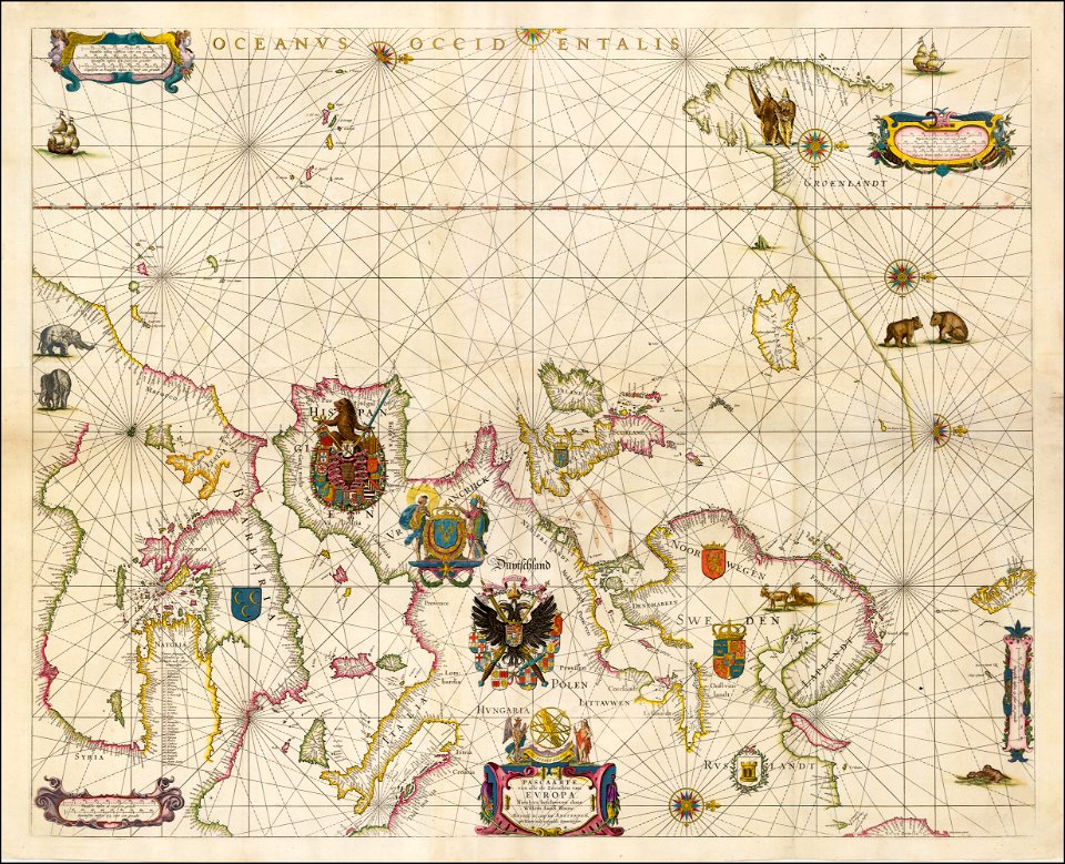
portolan charts by willem and johannes blaeu
17th-century maps of europe
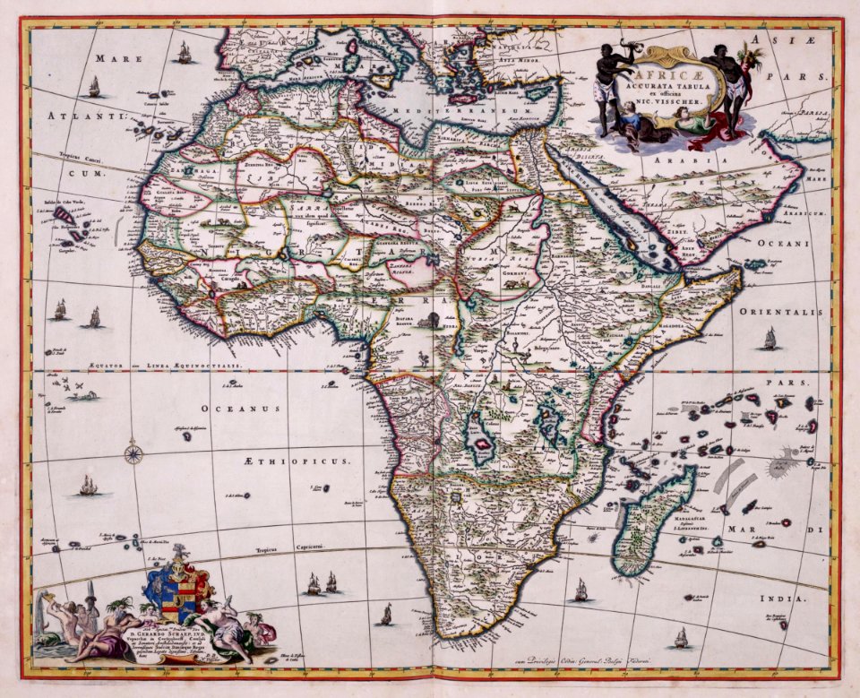
maps of the dutch east india company - south africa
gerard van keulen
old maps of the dutch east india company - africa
nicolaes visscher ii
gerard van keulen
1720s
johannes vingboons
1665
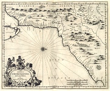
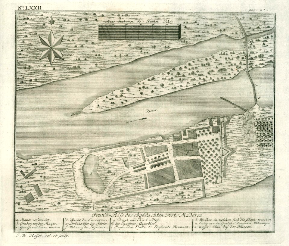
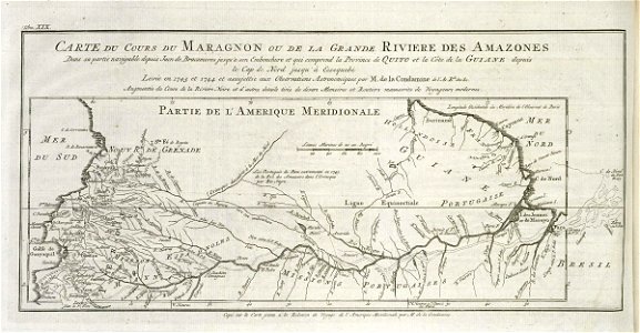
maps of the dutch east india company - india
1672
maps of the dutch east india company - india
1672
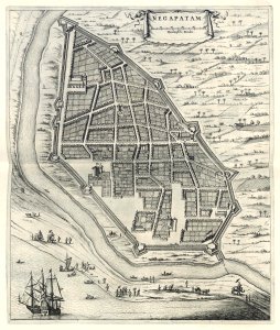
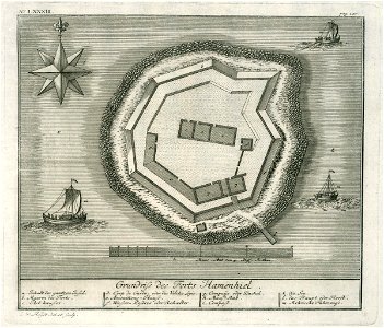
maps of the dutch east india company - sri lanka
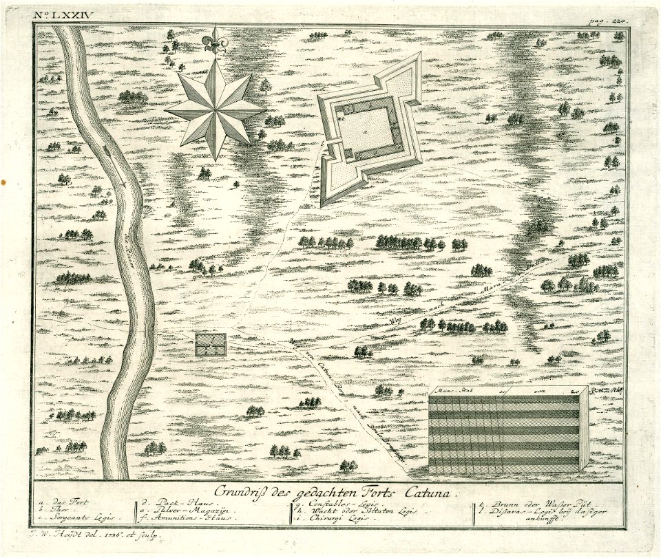
1736
maps of the dutch east india company - sri lanka
1730s
maps of the dutch east india company - india
1709
maps of the dutch east india company - sri lanka
1730s
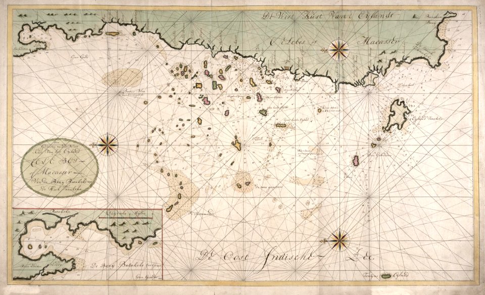
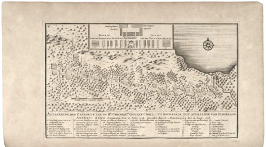
maps of the dutch east india company - indonesia
1724
maps of the dutch east india company - indonesia
1724
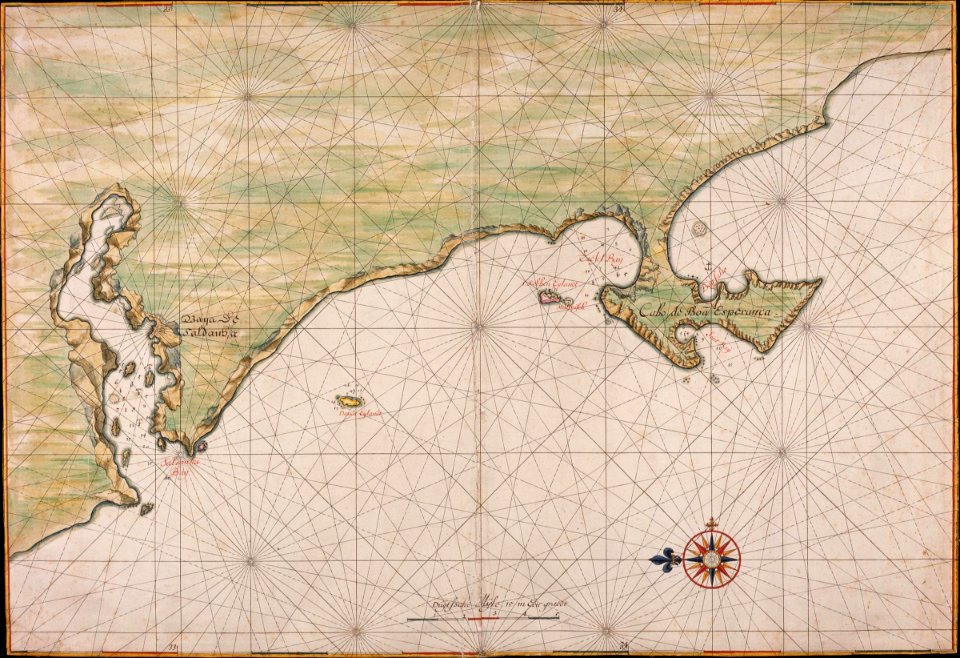
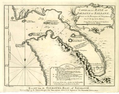
saldanha bay
1747)
maps of the west-indische compagnie
1772
frederick de wit
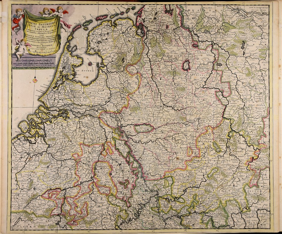
netherlands
geographical illustrations by coronelli
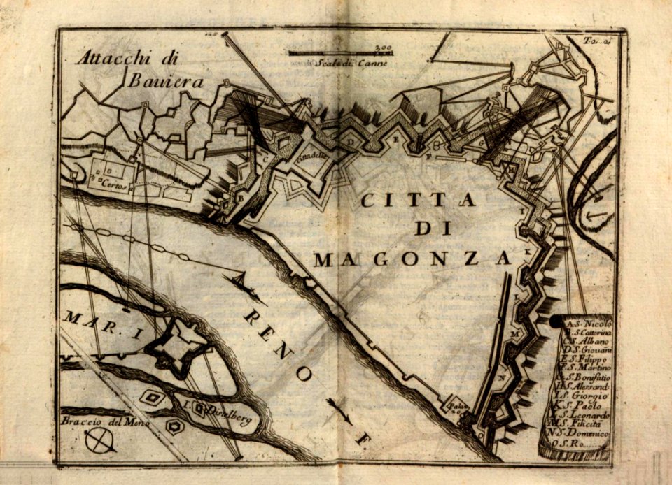
historical maps of mainz
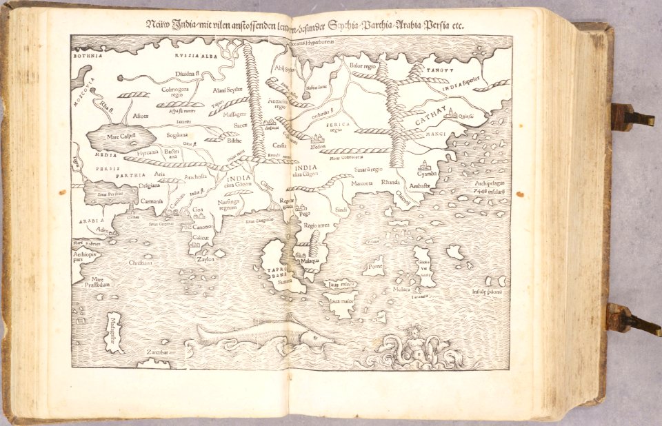
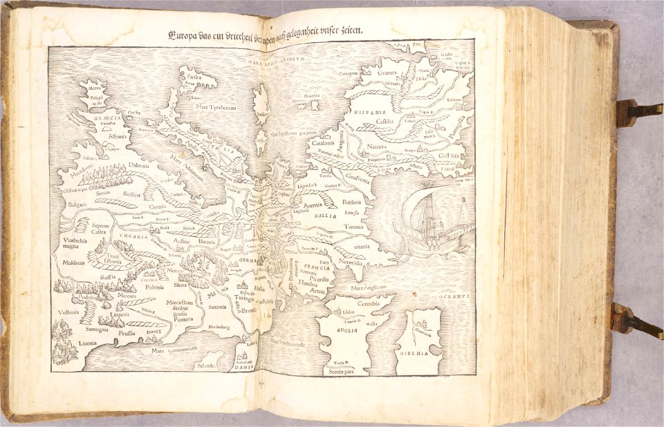
cosmographia - beschreibung aller lender durch sebastianum munsterum (1545)
1540s maps of asia
cosmographia - beschreibung aller lender durch sebastianum munsterum (1545)
1540s maps of europe
cosmographia - beschreibung aller lender durch sebastianum munsterum (1545)
1540s maps of africa
cosmographia - beschreibung aller lender durch sebastianum munsterum (1545)
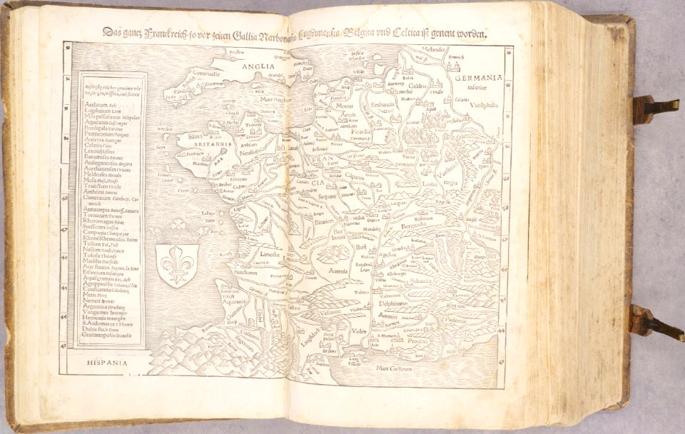
old maps of france
old maps of chartres
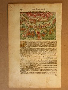
battles in art
geographical illustrations by coronelli
old maps of the peloponnese
geographical illustrations by coronelli
old maps of the peloponnese
geographical illustrations by coronelli
old maps of the peloponnese
geographical illustrations by coronelli
old maps of the peloponnese
voyage dans la macédoine (1831)
old maps of macedonia
collection de la bibliothèque municipale de reims
old maps of aube
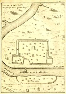
description de la chine
xiangyang
encyclopaedia universalis mundaneum
pacific
johann christoph brotze
old maps of riga
johann christoph brotze
old maps of riga
american revolutionary war
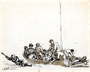
scrimshaw
7901 - 8000 of 1,095,865
Next page
/ 10959